Kanchenjunga Base Camp Trek
- Trip Duration20 Days
- Trip GradeStrenuous
- Max. Altitude5160 M Kanchenjunga base Camp
- Cost Starting FromContact Us
- Destination: Nepal
- Meals: Breakfast, Lunch and Dinner
- Transportation: Private Vehicle/Tourist Bus /Flight
- Accommodation: Lodge + Camping
- Max. Altitude: 5160 M Kanchenjunga base Camp
- Min. Group Size: 01 Minimum to 14 Maximum
Highlights
- 30 minutes flight to Biratnagar or Bhadrapur with stunning view of Himalaya ranges including Mt. Everest
- Ilam Tea garden on the way drive to Taplejung
- Experience authentic nepali culture and lifestyles
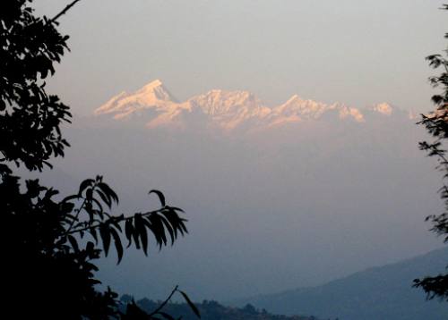
- Stunning view of Mt. Kanchenjunga, the World's 3rd highest mountain
- Visit of North and South base camp of Mt. Kanchenjunga and High mountain passes
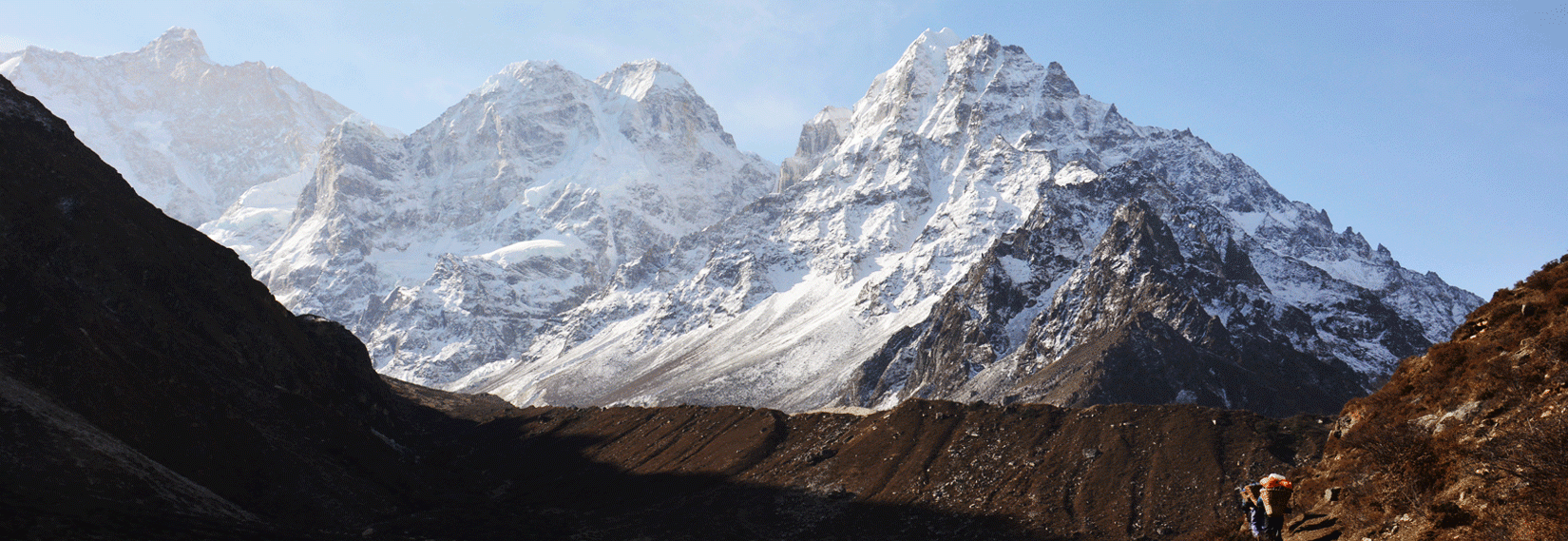
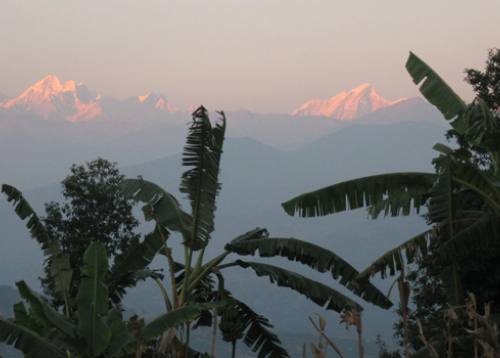
Kanchenjunga Base Camp Trek is an ideal trekking route for those with time and desire to venture into some of the remote regions of Nepal. Kanchenjunga is the third highest mountain in the world at 8586 meters, and is a magnificent peak striding the border between Nepal and India. Kanchenjunga base camp Trek begins from Suketar Taplejung accessible by air or Biratnagar / Basantapur accessible by road. Abundunt rhododendron and bamboo forests, dramatic mountain panorama, communities with ancient history and Mt Kanchenjunga, the third highest peak in the world, it all combines to make the Kanchenjunga Base Camp trek an offbeat trekking heaven.This is inside the Kanchenjunga Conservation Area which was one of the first areas of the Himalaya explored in the 19th centry. The area is first in Nepal to be managed by local communities and has proved quite successful in the main trail. However, it is yet to be fully effective in remote areas. Yet it remains largely unvisited by travelers. A permit is required to trek to this region.
Kanchenjunga Base Camp Trek begins along the Tamur River through Pipal trees and villages where traditional life is little touched by the modern world. This includes those of the Limbu people, famous for inventing Tongba (the highland concoction made from fermented millet) and as the mainstays in the British Gorkha Regiments.Passing through some of the country’s most pristine oak and rhododendron forests brings you to harsher high terrain. Crossing the Mirgin-La pass at 4725 meters gives you views of Makalu, Chamlang and Everest. Next you will pass the glacier, and finally you are rewarded with an incredible, close-up view of Kanchenjunga peak as you approach the Kanchenjunga base camp at Pang Pema. Whilst exploring the surrounding area you will also see a panorama of Wedge Peak, The Twins, Pyramid Peak and Tent Peak in our Kanchenjung base camp trekking.
Itinerary
Day 1Kathmandu – Biratnagar (72m/236ft), 35min flight.
The journey begins with an internal flight eastwards to Biratnagar, on the edge of the Indian plains, where we check into our hotel and have a free afternoon.
Day 2Biratnagar – Suketar – Mitlung (850m/2,790 ft), 15min flight, 5-6 hrs trek.
After breakfast and an early flight, we meet our porters at Suketar and then trek down to the village of Asahangpati and on to the Tamor Khola. This major river, and its tributaries, carries the waters off all the mountains to the north to the Ganges. Most villages are situated on high gentle slopes above steep sided valleys where agriculture is possible. We follow it upstream through bird filled forest, to the Chhetri village of Mitlung. Overnight at Mitlung.
Day 3Mitlung - Chirwa (1,190m/3,905ft), 6-7 hrs.
Today’s trail passes through dense patches of sub-tropical rainforest and follows the valley, from village to tributary crossings and up again. The region is home to ethnic Kirantis, now known as Limbus, who are chiefly involved in traditional agriculture. Beyond Sinwa, the valley narrows and the trail picks its way over landslides to Tawa. There are many bee hives in this region. Chirwa is a delightful cluster-village set amongst boulders: the campsite is next to a stream beyond the village. Overnight at Chirwa.
Day 4Chirwa - Sekathum (1,640m/5,390ft), 5-6 hrs.
Now the valley broadens and the landscape changes subtly. Cross the Sisuwa Khola and continue to Tapethok; the entrance and checkpoint to the Kangchenjunga Conservation Area. Wealthy cardamom farms surround the village. Follow the trail to a bridge over the Tamewa Khola and Tamewa and continue to Hellok. (Between these villages, a bridge leads west to the hilltop village of Lelep: headquarters of the KCA project.) Beyond Hellok, a suspension bridge crosses the Simbuwa Khola: the river that rises from the Yalung Glacier on Kangchenjunga’s south face. The next bridge crosses the Ghunsa Khola that rises from Kangchenjunga’s north face glacier. This is at its confluence with the Tamur Khola just below the village of Sekathum. The first views of Khumbakarna (Jannu) may be seen. Overnight at Sekathum.
Day 5Sekathum - Amjilosa (2,490m/8,168ft), 5-6hrs.
After breakfast, we follow the trail along the north bank of the Ghunsa Khola which is set in a steep sided and narrow valley. It passes through oak and rhododendron forest with bamboo undergrowth as well as small Sherpa settlements, mainly tending yaks: there is still evidence of extensive forest burning for slash-and-burn agriculture. After lunch, there is a steep climb up to the small and friendly Tibetan settlement of Amjilosa, set on a small level kharka with great views back down the valley. Overnight at Amjilosa.
Day 6Amjilosa - Gyabla (2,730m/8,955ft), 4-5hrs.
This is a fairly short day. The trail leads up to a flat ridge and then meanders through forests of bamboo, rhododendron, birch and brown oaks. It passes waterfalls and a few scattered summer pastures. Eventually it reaches a large set of rapids, after which a stiff climb leads up to the Sherpa village of Gyabla. The slopes around the village have been denuded for fields, but the forest remains pristine on the opposite side of the valley. Overnight at Gyabla.
Day 7Gyabla - Ghunsa (3,430m/11,250ft), 5-6hrs.
Today’s trail passes through hemlock and bamboo forest as it drops steeply into a ravine before levelling out. The forest gradually changes to alpine Himalayan fir and rhododendron as the path rises towards the large summer yak pastures and potato fields around the village of Phale (3,140m/10,302ft). There is a wooden Gompa with several statues and old thangkas, brought originally from Tibet.
Beyond Phale, the valley widens and the trail improves as it passes through larch forests and cultivated fields. It then dips down to cross the Ghunsa Khola and enter Ghunsa. This is the largest village in the region and is now occupied throughout the year: swelling in numbers as yaks and goats are brought up (and beyond) to pasture during the summer months.
Day 8Ghunsa Rest and acclimatisation day.
Ghunsa is an attractive Tibetan village with homesteads spaced in wood-enclosed fields. Steep forested slopes and almost sheer rock faces form the valley sides with snow-clad peaks towering 1,000m above.
Visit the monastery (belonging to the Khampa Dzong monasteries of Tibet) on the edge of the village. Look for locally made Tibetan carpets. Consider a day hike up the Yamatari Khola, along the Lapsang La trail, to a lake at the terminal moraine of the Yamatari glacier. Alternately follow the trail along the pipe line of the hydro electric plant towards the Tamo La: on the trail to Kangchenjunga’s south base camp. Bharal may be seen grazing above the village.
Day 9Ghunsa - Kambachen (4 150m/13,615ft), 5-6 hrs.
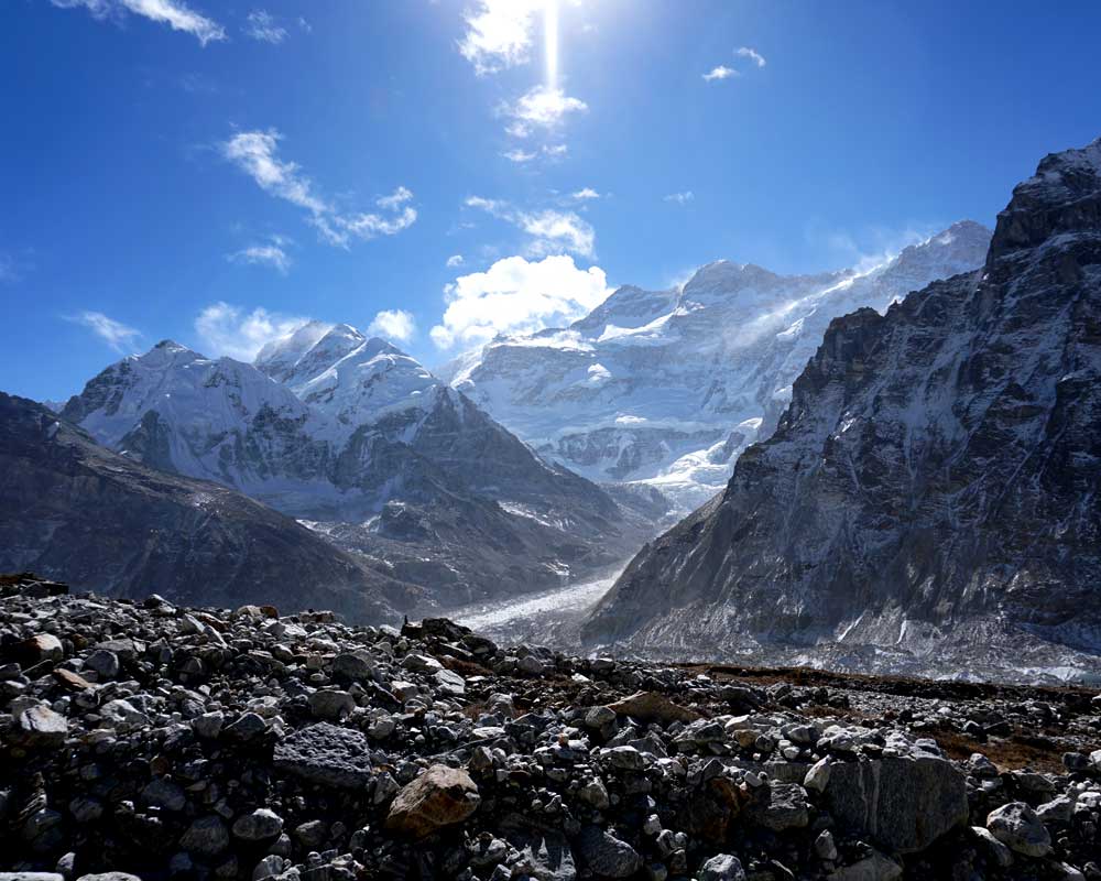
The trail leads north of Ghunsa through glorious larch and juniper forests on the east bank of the Ghunsa Khola. After crossing a sandy, boulder-strewn floodplain it crosses the river over a rickety, wood and stone bridge before climbing above the west bank to Rambuk Kharka (3,720m/12,205ft). The hillsides become increasingly barren as the trail rises past a high waterfall and rock falls along a narrow trail. Further on it crosses a large, sandy landslide before climbing more steeply while passing the impressive snout of the Khumbakarna (Jannu) Glacier on the opposite side of the valley. It then drops briefly into Kambachen. From here there are great views of several peaks including Jannu (7,710m/25,295ft). Lammergeyers, eagles, kites, falcons and choughs are commonly seen. Overnight at Kambachen.
Day 10Kambachen – Lhonak (4,790m/15,900ft), 4-5 hrs.
The landscape becomes increasingly desolate; forged over aeons by glacial ice. The path is not strenuous but for a time negotiates the stony river bed before reaching summer-pastoral huts at Ramtang (4,370m/14,338ft). Beyond is the snout of the Kangchenjunga Glacier which has been joined by the Ramtang Glacier. Higher up, the stony path climbs over the moraine and drops to the riverbed of the Ghunsa Khola as it leaves the Lhonak Glacier to the north. Ford the river or cross on a low unstable bridge to the summer grazing kharkas at Lhonak, situated well above the main glacier. There are three small buildings and some old stone walls amongst boulders that can assist with tent-shelter from the icy winds. Ice peaks rise in all directions with the 1½km ridge of Chang Himal (Wedge Peak) as centre piece. Tent Peak is prominent on the eastern horizon at the end of the visible glacier. Overnight at Lhonak.
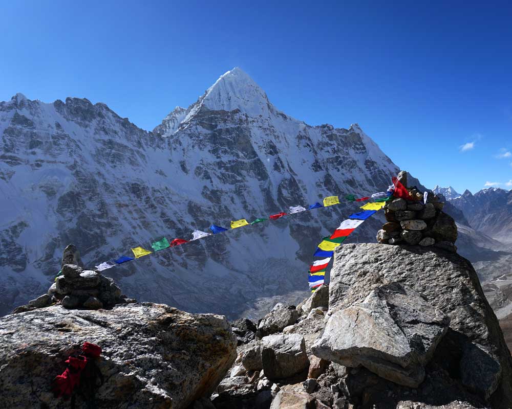
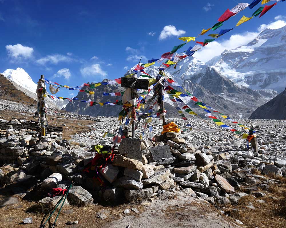
Day 11Lhonak – Pang Pema Base Camp (5,160m/16,923ft), 2-3 hrs
From Lhonak the Kangchenjunga Glacier flows eastwards for several kilometres before turning south to rise to its extensive head on the northern slopes of Kangchenjunga. The path follows the lip of the glacier over short grasses or rocky tracks that undulate with the terrain. Pang Pema lies opposite the head of the glacier and from here offers the first full view of the vast north face of the mountain. Overnight at Pang Pema.
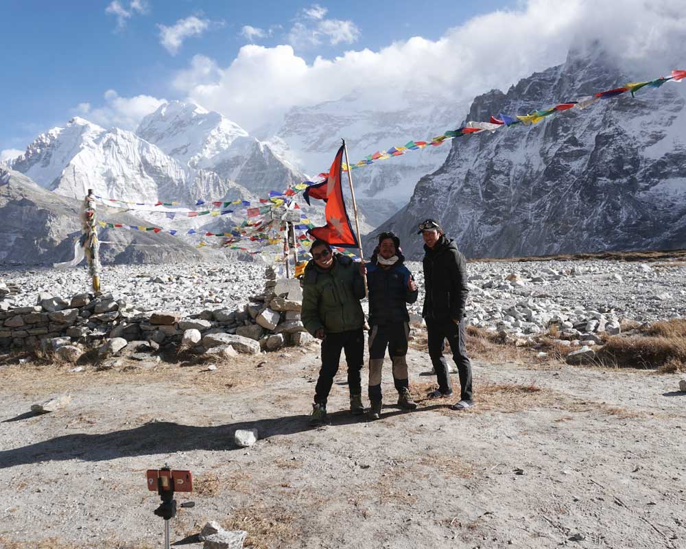
Day 12Pang Pema Base Camp, rest and exploration day.
The views from Pang Pema must rank amongst the most spectacular in the world. From Kangchenjunga, an unbroken wall of peaks, nowhere less than 6,100m/20,000ft forms the border with Sikkim and to the north, Tibet. Beyond the campsite the West Langpo Glacier flows into the Kangchenjunga Glacier. A difficult route north leads over the Jonsang La into Tibet. Climb the lower slopes of Drohma Ri (5,500m/18,045ft) behind the camp for better views of the mountain – at sunrise. Walk along the Langpo moraine to Corner Camp for better views of Pyramid Peak, et al. Overnight at Pang Pema.
Day 13Pangpema – Kambachen (4,150m/13,650ft), 5-6 hrs
The return journey from Pang Pema to Lhonak will be fairly slow, but beyond that the route is almost all downhill and thus Kambachen can easily be reached in a day. There are great views to enjoy. Overnight at Kambachen.
Day 14Kambachen – Ghunsa – Phale (3,140m/10,302ft), 5-6 hrs
Retrace the path down to Ghunsa, for lunch. Look out for pheasants in the forest. Cross the river below the village and continue downstream beside the Ghunsa Khola, through forest and farmland, to the Tibetan summer grazing village of Phale. Visit the wooden gompa. Overnight at Phale.
Day 15Phale – Amjilosa (2,140m/7,100ft), 5-6 hrs
The trail, through forests of rhododendron, conifer, birch and oak, continues down the valley, dropping to cross numerous tributaries to the last of the Tibetan villages at Gyabla. It then undulates on down to Amjilosa. Overnight at Amjilosa.
Day 16Amjilosa – Chirwa (1,190m/3,900 ft), 5-6 hrs
After the waterfall beyond the village, the path begins to descend fairly steeply to Sekathum: at the confluence of the Ghunsa and Tamur Kholas. The path then follows the western bank of the Tamur Khola and soon crosses the suspension bridge over the Simbuwa Khola that flows in from the Yarlung Glacier. An afternoon's walk leads to the riverside campsite a ¼hrs walk before the cluster-village of Chirwa. Overnight at Chirwa.
Day 17Chirwa – Linkhim (1,520m/4,985ft), 5-6 hrs
From Chirwa, leave the river trail and follow the trail that climbs above the east bank of the Tamor Khola to the hamlet at Thiwa (an exit point from the KCA). It then climbs high above the houses of Tawa, over a ridge before dropping into a side canyon to cross the Tawa Khola before climbing back to the ridge. It then passes above the hamlet of Malbanse before reaching Linkhim. Overnight at Linkhim.
Day 18Linkhim – Suketar (2,700m/8,856ft.), 5-6 hrs
From Linkhim, the trail winds in and out of side canyons to the Limbu village to Phurumbu and a ridge overlooking a vast landslide before Jogidanda. A final 3-4 hrs climb, through the Sherpa villages of Bung Kulung and Bhote Gaon leads to the airstrip at Suketar. Celebrate with a farewell dinner before saying goodbye to your trekking crew. Overnight at Suketar.
Day 19Suketar - Biratnagar- Kathmandu (1,300m/4,264ft), 30min and 35min flights.
After breakfast, board an early morning flight to Biratnagar and later an onward flight to Kathmandu from where you will be driven to your hotel. Afternoon free.
Trip Cost Details
Cost Include
- Airport picks up and drops as per group size
- All applicable transportation
- Flight fare Kathmandu / Biratnagar / Kathmandu (Guide + Guests) including Airport Taxes
- 3 meals per day during the trek (Breakfast Lunch & Dinner) including Tea or coffee
- Accommodation ( Mountain Lodge ) on twin sharing or provided Tents during the trek as mentioned in the itinerary
- Accommodation in kathmandu on bed & breakfast basis
- An Experienced English speaking Guide
- Kanchenjunga National park Fees
- Special permit for Kanchenjunga Base Canp
- TIMS Trekkers information Management System
- Necessary porter during the trek
- All Guide and Sherpa's salary, Equipment and insurance during the trekking
- First Aid kit
- Farewell Dinner with Typical Nepali restaurant
- All Government local Taxes
Cost Exclude
- All personal expenses during the trek
- Lunch and Dinner in Kathmandu
- Trekking equipment any type of personal expenses such as Alcoholic Beverage drinks, phone and Laundry
- Emergency Rescue and Travel Insurance.
- Trip Cancellation cost accident or Health, Loss Theft or Damage and personal effects
- Tipping to guide and porters
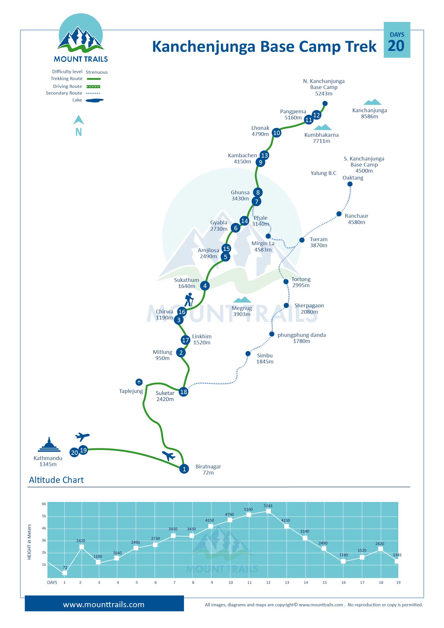
Trip Map
Useful Info
Accommodations
The accommodation we have been providing in Katmandu is deluxe hotel and mountain best available guest house according to the guest demands and need. During the trek we provide standard Guest House with sound environment and hygienic food for the guest to make their trip happening and healthy. Being third highest mountain Kanchenjunga is collecting many tourist. so, there obviously better Lodge and facilities in compared to previous times. Since, Kanchenjunga Trek is camping trek we provide comfortable dining, kitchen, crew, restroom tents and sleeping materials like mattress, Sleeping bags etc. We provide twin tent for our guest.
Meals
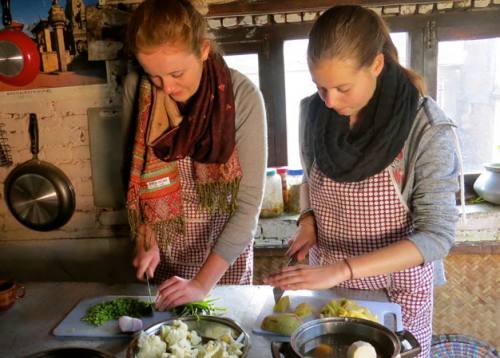
We get different choices of food especially in the cities areas especially in Kathmandu valley with lots of restaurants serve different cuisine but during the camping trek we get to eat from Continental, Indian and Nepali menu especially choices like Pasta, Pizza, Mo. Mo, soup items, Potatoes items, Dal Bhat, Hot drinks Tea & Coffee etc. Our camping cook are well trained and certified from Nepal Academy of Tourism and hotel Management.
Our Team
Being homeland of Himalayas, it’s obvious to have challenging routes, High altitude problems, Weather and other conditions; any of those situations is big enough to ruin your trip. Leading around the steeply hills and rocky routes is not a job of common climbers and trekkers. Mounttrails Trekking and Adventures have been providing local trekking expert leaders and staffs working in this field perfectly since long years to overcome tough challenges and make your trip a life time memory. They are trained and well certified by the Government of Nepal. All of our staffs have received emergency guidance in Himalaya’s and have knowledge of first Aid for our guest. We never compromise giving safety to our staffs, therefore we provide insurance and medical services during the trek and compensation when they need especially to Porters, Kitchen member and other.
Best Season to Trek in Nepal
Autumn (September - November) and Spring (March - May) is the best trekking season for the trekking and mountaineering in Nepal. Weather is mostly clear and temperature is moderate which offers beautiful views without any obstruction. Spring collects beautiful flowers, plants and rare animals Walking is also very much suitable during this season.
Summer (June - August) and Winter (December - February). Though Summer collects heavy monsoon rainfall it is very much clear to trek around Mustang, Dolpo and Nar- Phu valley since they are rain shadow areas. Tibet is much more favorable for Tibet trek. Everest, Langtang and Annapurna are always comfortable to trek even in winter season.
Experience & Fitness
Trekking in Nepal for Kanchenjunga Trek does not require past experience, though we have challenging route in Everest compared to Annapurna our itinerary suggests to walk comfortable distances. Trekking in Himalayas always takes us to challenging altitudes and rocky routes, demands proper rest time and acclimatization to sustain their strength. We always have both listed properly in our itinerary. However certain training like Running, Skipping and other workout will definitely help you in roots.
Acclimatization
Altitude sickness is a significant risk when trekking on any trails above about 2,500m. However good health, proper care and drinking plenty of water will definitely help you to prevent from altitude sickness. Every trekkers needs to be familiar with the heights so, for this we have life saving acclimatization days during the trek, peak climbing and expedition. We also provide certain medical support for your relief and emergency rescue through helicopter whenever guest require.
Eco Friendly
Mount Trails is very much concern agency on environment pollution and Global Warming. We are always serious and genuine towards our garbage during the trek especially in Camping type. We collect all the rubbish and deposit it to proper place to protect our environment. We also suggest all travelers to protect our environment and Stop Global Warming.
Trip Note
We have tailor-made program for Kanchenjunga Trek. Days in the itinerary are always flexible, can be increased & decreased depending on your holiday and time schedule. Trekking in Everest around the Himalayan region goes through unexpected complication like natural and health challenges resulting chances in the itinerary for your security during the trek by our professional guides and leader to take you to final point safe and sound so, please cooperate with your guide for you protection.
The Trip cost depends on the Group Size and number of days so please contact us for the best deal @ [email protected]
-
-
-
Chitwan Jungle Safari 1 night 2 Days
- 2 Days
- US$ 90 All-In
-
-
-
Chitwan Jungle Safari 2 nights 3 Days
- 3 Days
- US$ 130 All-In
-
Breakfast on Mountain
- 1 Day
- US$ 125 All-In
-
Recommended Add-ons
Associated with:


